Map of Horley station
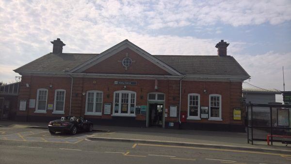
Horley station
| Postcode | RH6 7NL |
|---|
Transport
| Nearby stations | |
|---|---|
| Bus stops |
Horley Railway Station (E)
Horley Railway Station Approach (SE)
Horley Railway Station Approach (SE)
Town Centre (S)
The Drive (S)
The Drive (N)
|
| Station code (TLC) | HOR |
| Station code (NLC) | 5365 |
| Owner | Govia Thameslink Railway (Southern) |
| National Rail Enquiries | |
Live Departures
Live Arrivals
Usage
Entries and exits
Interchanges
| Year | Entries and exits | Annual change % | Interchanges | Annual change % |
|---|---|---|---|---|
| 2025 | 1,312,392 | 7.6 % | ||
| 2024 | 1,219,268 | 18.0 % | ||
| 2023 | 1,033,666 | 29.3 % | ||
| 2022 | 799,638 | 188.1 % | ||
| 2021 | 277,546 | -72.5 % | ||
| 2020 | 1,009,654 | 4.1 % | ||
| 2019 | 969,592 | -0.2 % | ||
| 2018 | 971,834 | 5.2 % | ||
| 2017 | 923,774 | -14.1 % | ||
| 2016 | 1,076,010 | 9.2 % | ||
| 2015 | 984,932 | 3.1 % | ||
| 2014 | 955,388 | 0.4 % | ||
| 2013 | 952,022 | 1.9 % | ||
| 2012 | 934,498 | 5.7 % | ||
| 2011 | 883,908 | -1.8 % | ||
| 2010 | 900,184 | -17.9 % | ||
| 2009 | 1,096,774 | 7.3 % | ||
| 2008 | 1,021,682 | 21.8 % | ||
| 2007 | 838,545 | 0.6 % | ||
| 2006 | 833,201 | -1.3 % | ||
| 2005 | 844,231 |
Note: Data is for financial years, so 2020 is April 2019 to March 2020
Geography
| Latitude | 51.168774 | |
|---|---|---|
| Longitude | -0.161054 | |
| Easting | 528665 | |
| Northing | 142666 | |
| Grid reference | TQ286426 | |
| UTM reference | 30U 698466 5672425 | |
| what3words | ||
| Plus code | ||
| Distance away |
Postcodes
This map shows the postcodes where this station is the nearest to the postcode (as the crow flies)