Map of Portsmouth Harbour station
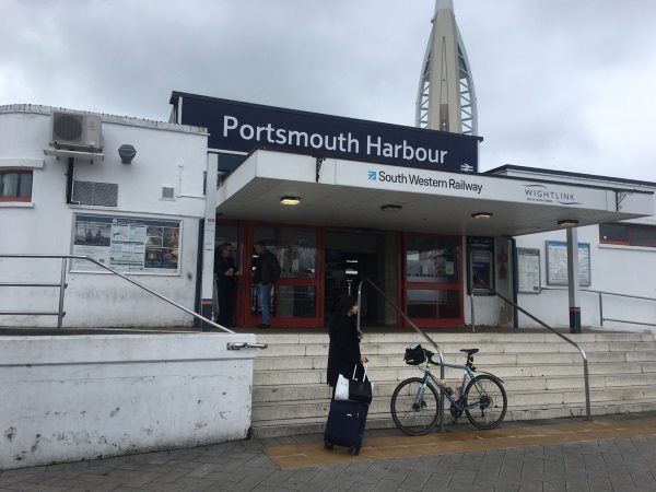
Photo: Martin W
Portsmouth Harbour station
| Postcode | PO1 3PA |
|---|
Transport
| Nearby stations | |
|---|---|
| Bus stops |
St Georges Square (SE)
Gunwharf Quays (N)
Gunwharf Quays (S)
Broad Street (E)
Curzon Howe Road (E)
Curzon Howe Road (W)
|
| Station code (TLC) | PMH |
| Station code (NLC) | 5540 |
| Owner | South Western Railway |
| National Rail Enquiries | |
Live Departures
Live Arrivals
Usage
Entries and exits
Interchanges
| Year | Entries and exits | Annual change % | Interchanges | Annual change % |
|---|---|---|---|---|
| 2024 | 1,775,688 | 1.7 % | 45,145 | 249.4 % |
| 2023 | 1,746,574 | 20.1 % | 12,920 | -68.5 % |
| 2022 | 1,454,738 | 169.5 % | 41,024 | 181.4 % |
| 2021 | 539,728 | -73.5 % | 14,576 | -88.0 % |
| 2020 | 2,035,930 | -3.1 % | 120,995 | -35.6 % |
| 2019 | 2,100,528 | 3.2 % | 188,018 | 30.1 % |
| 2018 | 2,035,448 | -1.1 % | 144,488 | -0.6 % |
| 2017 | 2,058,681 | -4.8 % | 145,419 | -8.0 % |
| 2016 | 2,162,417 | -2.0 % | 158,034 | -15.6 % |
| 2015 | 2,206,210 | -2.9 % | 187,158 | 2.7 % |
| 2014 | 2,272,038 | 3.4 % | 182,258 | 5.8 % |
| 2013 | 2,197,072 | 18.7 % | 172,296 | -4.7 % |
| 2012 | 1,851,570 | -2.8 % | 180,874 | -6.0 % |
| 2011 | 1,904,571 | 3.7 % | 192,409 | 8.0 % |
| 2010 | 1,835,835 | 0.5 % | 178,153 | -5.0 % |
| 2009 | 1,826,011 | 11.2 % | 187,529 | 5.9 % |
| 2008 | 1,642,787 | 18.1 % | 177,140 | -18.2 % |
| 2007 | 1,391,084 | 223.5 % | 216,443 | -2.6 % |
| 2006 | 429,945 | -30.6 % | 222,144 | -6.3 % |
| 2005 | 619,619 | 236,997 |
Note: Data is for financial years, so 2020 is April 2019 to March 2020
Geography
| Latitude | 50.796962 | |
|---|---|---|
| Longitude | -1.10784 | |
| Easting | 462973 | |
| Northing | 100090 | |
| Grid reference | SU629000 | |
| UTM reference | 30U 633345 5628953 | |
| what3words | ||
| Plus code | ||
| Distance away |
Postcodes
This map shows the postcodes where this station is the nearest to the postcode (as the crow flies)