Map of West Brompton station, London
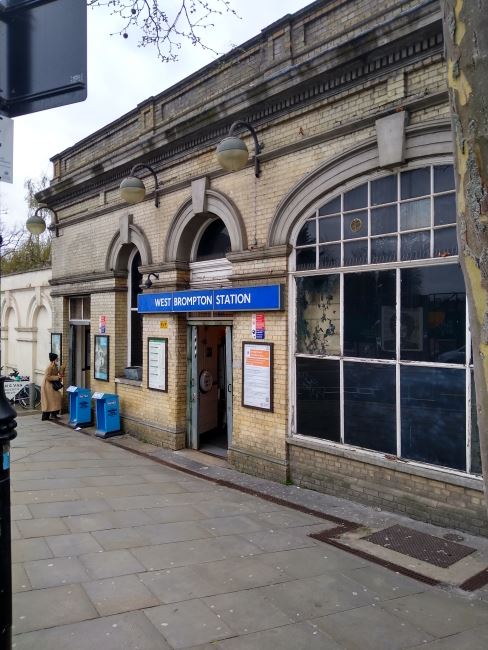
West Brompton station
| Postcode | SW5 9JX |
|---|
Transport
| Travel zone | 2 |
|---|---|
| Tube/Rail lines | |
| Next stations | |
| Nearby stations | |
| Bus stops |
West Brompton Station (W)
Earls Court Square (NW)
Empress State Bldg W Brompton (NW)
Empress State Bldg W Brompton (E)
Empress State Bldg W Brompton (W)
Old Brompton Road (N)
|
| Station code (TLC) | WBP |
| Station code (NLC) | 8875 |
| Owner | London Underground |
| National Rail Enquiries | |
Live Departures
Live Arrivals
Usage
Entries and exits
Interchanges
| Year | Entries and exits | Annual change % | Interchanges | Annual change % |
|---|---|---|---|---|
| 2024 | 4,252,304 | 21.1 % | ||
| 2023 | 3,510,570 | 16.0 % | ||
| 2022 | 3,027,020 | 114.5 % | ||
| 2021 | 1,411,158 | -68.8 % | ||
| 2020 | 4,516,992 | -8.5 % | ||
| 2019 | 4,936,112 | -6.0 % | ||
| 2018 | 5,249,832 | 0.4 % | ||
| 2017 | 5,226,416 | -7.1 % | ||
| 2016 | 5,625,750 | 67.2 % | ||
| 2015 | 3,365,504 | 33.3 % | ||
| 2014 | 2,524,228 | 0.9 % | ||
| 2013 | 2,501,626 | 18.9 % | ||
| 2012 | 2,103,946 | 39.7 % | ||
| 2011 | 1,506,006 | 69.7 % | ||
| 2010 | 887,692 | 37.9 % | ||
| 2009 | 643,852 | -13.1 % | ||
| 2008 | 741,328 | 42.9 % | ||
| 2007 | 518,781 | 26.0 % | ||
| 2006 | 411,667 | 31.2 % | ||
| 2005 | 313,725 |
Note: Data is for financial years, so 2020 is April 2019 to March 2020
Geography
| Latitude | 51.48706 | |
|---|---|---|
| Longitude | -0.195593 | |
| Easting | 525383 | |
| Northing | 178030 | |
| Grid reference | TQ253780 | |
| UTM reference | 30U 694699 5707719 | |
| what3words | ||
| Plus code | ||
| Distance away |
Postcodes
This map shows the postcodes where this station is the nearest to the postcode (as the crow flies)