Map of Imperial Wharf station, London
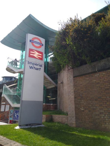
Imperial Wharf station
| Postcode | SW6 2HA |
|---|
Transport
| Travel zone | 2 |
|---|---|
| Tube/Rail lines | |
| Next stations | |
| Nearby stations | |
| Bus stops |
Imperial Road (S)
Imperial Whf Stn Chelsea Hrbr (S)
Imperial Wharf Station Imperial Road (N)
Imperial Whf Stn Chelsea Hrbr (SE)
Bagleys Lane (S)
Imperial Road Chelsea Harbour (NW)
|
| Station code (TLC) | IMW |
| Station code (NLC) | 9586 |
| Owner | London Overground |
| National Rail Enquiries | |
Live Departures
Live Arrivals
Usage
Entries and exits
Interchanges
| Year | Entries and exits | Annual change % | Interchanges | Annual change % |
|---|---|---|---|---|
| 2024 | 3,017,980 | 11.5 % | ||
| 2023 | 2,706,930 | 16.5 % | ||
| 2022 | 2,324,442 | 130.1 % | ||
| 2021 | 1,010,064 | -64.7 % | ||
| 2020 | 2,863,374 | -8.3 % | ||
| 2019 | 3,123,322 | -2.2 % | ||
| 2018 | 3,193,608 | 1.9 % | ||
| 2017 | 3,133,002 | -4.8 % | ||
| 2016 | 3,290,200 | 65.9 % | ||
| 2015 | 1,982,780 | 9.0 % | ||
| 2014 | 1,818,380 | 15.1 % | ||
| 2013 | 1,579,564 | 28.3 % | ||
| 2012 | 1,230,734 | 66.9 % | ||
| 2011 | 737,388 | 518.4 % | ||
| 2010 | 119,250 | |||
| 2009 | ||||
| 2008 | ||||
| 2007 | ||||
| 2006 | ||||
| 2005 |
Note: Data is for financial years, so 2020 is April 2019 to March 2020
Geography
| Latitude | 51.474948 | |
|---|---|---|
| Longitude | -0.182823 | |
| Easting | 526299 | |
| Northing | 176674 | |
| Grid reference | TQ262766 | |
| UTM reference | 30U 695637 5706407 | |
| what3words | ||
| Plus code | ||
| Distance away |
Postcodes
This map shows the postcodes where this station is the nearest to the postcode (as the crow flies)