Map of West Drayton station, London
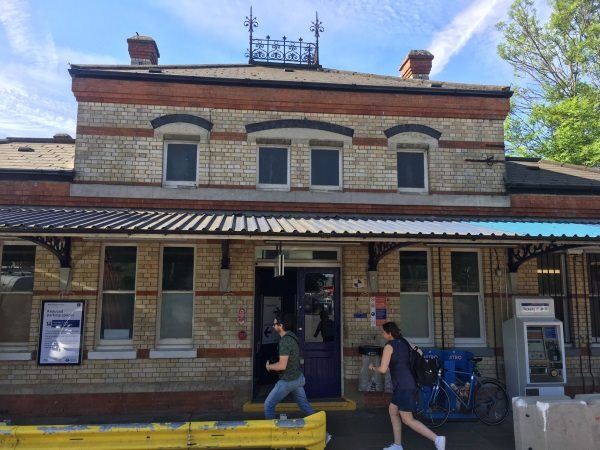
Photo: Martin W
West Drayton station
| Postcode | UB7 9DY |
|---|
Transport
| Travel zone | 6 |
|---|---|
| Tube/Rail lines | |
| Next stations | |
| Nearby stations | |
| Bus stops |
West Drayton Station (W)
Albert Road Yiewsley (E)
Albert Road Yiewsley (W)
Ferrers Avenue (S)
Ferrers Avenue (N)
Yiewsley High Street (S)
|
| Station code (TLC) | WDT |
| Station code (NLC) | 3174 |
| Owner | TfL Rail |
| National Rail Enquiries | |
Live Departures
Live Arrivals
Usage
Entries and exits
Interchanges
| Year | Entries and exits | Annual change % | Interchanges | Annual change % |
|---|---|---|---|---|
| 2024 | 3,224,836 | 21.1 % | ||
| 2023 | 2,661,884 | 53.8 % | ||
| 2022 | 1,731,236 | 143.1 % | ||
| 2021 | 712,282 | -70.1 % | ||
| 2020 | 2,379,932 | 8.3 % | ||
| 2019 | 2,197,016 | 7.4 % | ||
| 2018 | 2,045,624 | -1.0 % | ||
| 2017 | 2,066,386 | -2.8 % | ||
| 2016 | 2,125,160 | -9.3 % | ||
| 2015 | 2,342,234 | 13.7 % | ||
| 2014 | 2,059,712 | 9.0 % | ||
| 2013 | 1,888,888 | 6.1 % | ||
| 2012 | 1,780,822 | 5.5 % | ||
| 2011 | 1,687,748 | 34.4 % | ||
| 2010 | 1,255,442 | -8.9 % | ||
| 2009 | 1,377,622 | -8.2 % | ||
| 2008 | 1,500,991 | 13.6 % | ||
| 2007 | 1,320,847 | 65.1 % | ||
| 2006 | 799,977 | 7.7 % | ||
| 2005 | 742,777 |
Note: Data is for financial years, so 2020 is April 2019 to March 2020
Geography
| Latitude | 51.510054 | |
|---|---|---|
| Longitude | -0.472234 | |
| Easting | 506124 | |
| Northing | 180122 | |
| Grid reference | TQ061801 | |
| UTM reference | 30U 675407 5709576 | |
| what3words | ||
| Plus code | ||
| Distance away |
Postcodes
This map shows the postcodes where this station is the nearest to the postcode (as the crow flies)