Map of Blackfriars station, London
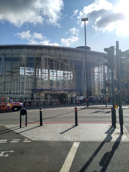
Blackfriars station
| Postcode | EC4V 4DD |
|---|
Transport
| Travel zone | 1 |
|---|---|
| Tube/Rail lines | |
| Next stations | |
| Nearby stations | |
| Bus stops |
Blackfriars Station North Entrance (N)
Apothecary Street (S)
Blackfriars Station North Entrance (S)
Blackfriars (E)
City Thameslink Stn Ludgate Circus (W)
Ludgate Hill Old Bailey (E)
|
| Station code (TLC) | BFR |
| Station code (NLC) | 5112 |
| Owner | Govia Thameslink Railway (Thameslink) |
| National Rail Enquiries | |
Live Departures
Live Arrivals
Usage
Entries and exits
Interchanges
| Year | Entries and exits | Annual change % | Interchanges | Annual change % |
|---|---|---|---|---|
| 2025 | 15,193,088 | 8.9 % | 2,234,915 | 1.9 % |
| 2024 | 13,945,996 | 8.1 % | 2,193,097 | -71.6 % |
| 2023 | 12,904,992 | 115.7 % | 7,722,022 | 414.8 % |
| 2022 | 5,982,098 | 184.9 % | 1,500,087 | 158.4 % |
| 2021 | 2,099,774 | -83.8 % | 580,540 | -80.2 % |
| 2020 | 12,992,870 | 7.0 % | 2,931,634 | 10.2 % |
| 2019 | 12,139,538 | 12.4 % | 2,659,638 | 189.2 % |
| 2018 | 10,802,146 | 2.1 % | 919,689 | 10.8 % |
| 2017 | 10,576,046 | 1.0 % | 830,377 | 9.5 % |
| 2016 | 10,467,646 | -30.9 % | 758,569 | -36.8 % |
| 2015 | 15,149,024 | 5.1 % | 1,199,416 | -12.1 % |
| 2014 | 14,412,166 | 10.7 % | 1,364,886 | 4.3 % |
| 2013 | 13,022,242 | 1.8 % | 1,309,238 | 23.6 % |
| 2012 | 12,791,472 | 0.7 % | 1,059,003 | 90.6 % |
| 2011 | 12,708,075 | 5.1 % | 555,747 | -16.9 % |
| 2010 | 12,089,453 | -6.7 % | 668,840 | 60.3 % |
| 2009 | 12,959,108 | 4.2 % | 417,327 | -30.7 % |
| 2008 | 12,440,374 | 5.0 % | 602,072 | -23.1 % |
| 2007 | 11,852,397 | 43.5 % | 783,255 | 12.7 % |
| 2006 | 8,258,915 | 6.1 % | 695,101 | 84.0 % |
| 2005 | 7,782,674 | 377,728 |
Note: Data is for financial years, so 2020 is April 2019 to March 2020
Geography
| Latitude | 51.511808 | |
|---|---|---|
| Longitude | -0.103332 | |
| Easting | 531738 | |
| Northing | 180890 | |
| Grid reference | TQ317808 | |
| UTM reference | 30U 700994 5710720 | |
| what3words | ||
| Plus code | ||
| Distance away |
Postcodes
This map shows the postcodes where this station is the nearest to the postcode (as the crow flies)