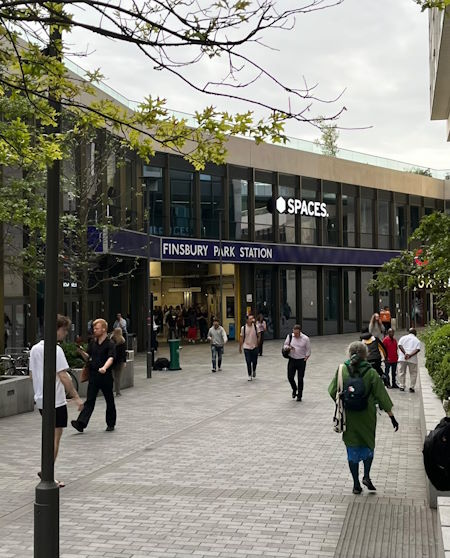
Map of Finsbury Park station, London

Photo: Jo B
Finsbury Park station
| Postcode | N4 3JU |
|---|
Transport
| Travel zone | 2 |
|---|---|
| Tube/Rail lines | |
| Next stations | |
| Nearby stations | |
| Bus stops |
Finsbury Park (W)
Finsbury Park Interchange (N)
Finsbury Park Interchange (S)
Finsbury Park Bus Station (E)
Fonthill Road (E)
Rock Street (W)
|
| Station code (TLC) | FPK |
| Station code (NLC) | 6119 |
| Owner | Govia Thameslink Railway (Great Northern) |
| National Rail Enquiries | |
Live Departures
Live Arrivals
Usage
Entries and exits
Interchanges
| Year | Entries and exits | Annual change % | Interchanges | Annual change % |
|---|---|---|---|---|
| 2024 | 9,363,598 | 9.4 % | 2,134,408 | -36.5 % |
| 2023 | 8,559,032 | 86.0 % | 3,360,327 | 76.8 % |
| 2022 | 4,600,424 | 128.5 % | 1,900,652 | 184.3 % |
| 2021 | 2,013,500 | -73.7 % | 668,550 | -82.5 % |
| 2020 | 7,669,706 | 0.7 % | 3,809,953 | 27.5 % |
| 2019 | 7,614,996 | 12.3 % | 2,987,609 | 71.2 % |
| 2018 | 6,781,272 | -3.6 % | 1,744,898 | 31.6 % |
| 2017 | 7,032,726 | 24.3 % | 1,325,849 | -24.0 % |
| 2016 | 5,656,786 | -9.7 % | 1,744,098 | 66.8 % |
| 2015 | 6,263,994 | -2.6 % | 1,045,407 | -7.7 % |
| 2014 | 6,429,584 | -0.0 % | 1,133,109 | -0.8 % |
| 2013 | 6,430,270 | -0.3 % | 1,141,707 | -10.7 % |
| 2012 | 6,448,792 | -12.1 % | 1,278,866 | -9.4 % |
| 2011 | 7,337,297 | 11.7 % | 1,411,339 | -44.2 % |
| 2010 | 6,566,019 | 19.6 % | 2,529,271 | -3.8 % |
| 2009 | 5,492,164 | -1.0 % | 2,629,184 | 8.6 % |
| 2008 | 5,545,881 | -5.6 % | 2,421,899 | 134.3 % |
| 2007 | 5,875,109 | 16.5 % | 1,033,482 | -38.6 % |
| 2006 | 5,041,828 | 0.4 % | 1,682,061 | 114.4 % |
| 2005 | 5,021,634 | 784,459 |
Note: Data is for financial years, so 2020 is April 2019 to March 2020
Geography
| Latitude | 51.5643 | |
|---|---|---|
| Longitude | -0.106285 | |
| Easting | 531385 | |
| Northing | 186784 | |
| Grid reference | TQ313867 | |
| UTM reference | 30U 700558 5716548 | |
| what3words | ||
| Plus code | ||
| Distance away |
Postcodes
This map shows the postcodes where this station is the nearest to the postcode (as the crow flies)