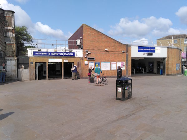
Map of Highbury and Islington station, London

Highbury and Islington station
| Postcode | N1 1SE |
|---|
Transport
| Travel zone | 2 |
|---|---|
| Tube/Rail lines | |
| Next stations | |
| Nearby stations | |
| Bus stops |
Highbury & Islington Station (NW)
Highbury Corner (N)
Upper Street Laycock Street (S)
Highbury Corner (W)
St Paul's RoadHighbury Corner (E)
Canonbury Road Highbury Corner (S)
|
| Station code (TLC) | HHY |
| Station code (NLC) | 6009 |
| Owner | London Underground |
| National Rail Enquiries | |
Live Departures
Live Arrivals
Usage
Entries and exits
Interchanges
| Year | Entries and exits | Annual change % | Interchanges | Annual change % |
|---|---|---|---|---|
| 2024 | 21,827,580 | 6.0 % | 3,779,900 | -44.7 % |
| 2023 | 20,601,096 | 15.6 % | 6,839,511 | 211.9 % |
| 2022 | 17,816,284 | 105.7 % | 2,192,742 | 96.5 % |
| 2021 | 8,660,736 | -70.5 % | 1,115,752 | -67.2 % |
| 2020 | 29,398,624 | -3.4 % | 3,397,228 | -14.3 % |
| 2019 | 30,439,574 | 3.2 % | 3,964,059 | -24.1 % |
| 2018 | 29,507,772 | -1.2 % | 5,220,451 | 36.1 % |
| 2017 | 29,852,702 | 6.0 % | 3,837,080 | 35.4 % |
| 2016 | 28,166,440 | 41.0 % | 2,834,363 | -2.0 % |
| 2015 | 19,975,522 | 26.1 % | 2,893,368 | 42.0 % |
| 2014 | 15,840,018 | 7.8 % | 2,037,285 | 15.3 % |
| 2013 | 14,695,098 | 24.5 % | 1,766,463 | -10.4 % |
| 2012 | 11,800,800 | 54.8 % | 1,971,257 | 517.1 % |
| 2011 | 7,625,235 | 34.5 % | 319,413 | 83.8 % |
| 2010 | 5,668,133 | 35.8 % | 173,814 | 40.1 % |
| 2009 | 4,173,338 | -12.2 % | 124,077 | -9.6 % |
| 2008 | 4,751,391 | -1.2 % | 137,272 | 73.0 % |
| 2007 | 4,809,098 | 79,370 | ||
| 2006 | ||||
| 2005 |
Note: Data is for financial years, so 2020 is April 2019 to March 2020
Geography
| Latitude | 51.546176 | |
|---|---|---|
| Longitude | -0.103764 | |
| Easting | 531562 | |
| Northing | 184770 | |
| Grid reference | TQ315847 | |
| UTM reference | 30U 700813 5714540 | |
| what3words | ||
| Plus code | ||
| Distance away |
Postcodes
This map shows the postcodes where this station is the nearest to the postcode (as the crow flies)