Map of Hounslow station, London
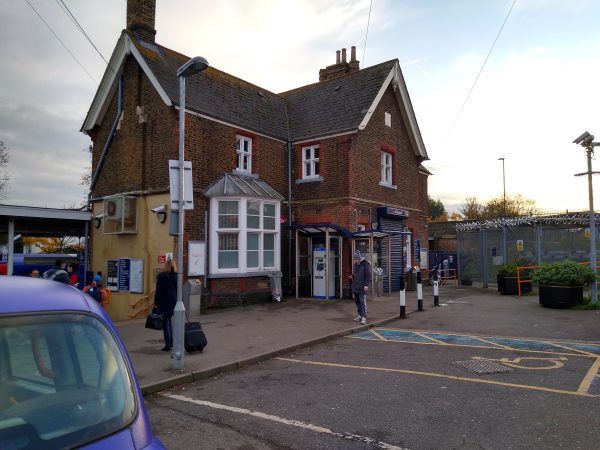
Hounslow station
| Postcode | TW3 3DL |
|---|
Transport
| Travel zone | 5 |
|---|---|
| Tube/Rail lines | |
| Next stations | |
| Nearby stations | |
| Bus stops |
Hounslow (N)
Park Road Whitton Road (N)
Park Road Whitton Road (S)
Pownall Gardens (S)
Heath Road Hounslow (E)
Pownall Gardens (N)
|
| Station code (TLC) | HOU |
| Station code (NLC) | 5563 |
| Owner | South Western Railway |
| National Rail Enquiries | |
Live Departures
Live Arrivals
Usage
Entries and exits
Interchanges
| Year | Entries and exits | Annual change % | Interchanges | Annual change % |
|---|---|---|---|---|
| 2025 | 850,306 | 3.3 % | 1,382 | 40.9 % |
| 2024 | 823,164 | 8.0 % | 981 | -7.5 % |
| 2023 | 761,872 | 10.1 % | 1,060 | -90.6 % |
| 2022 | 692,128 | 86.3 % | 11,299 | 132.9 % |
| 2021 | 371,612 | -69.1 % | 4,851 | -77.1 % |
| 2020 | 1,203,034 | -3.8 % | 21,160 | 564.4 % |
| 2019 | 1,249,956 | 7.9 % | 3,185 | -7.8 % |
| 2018 | 1,158,818 | -1.6 % | 3,455 | 54.2 % |
| 2017 | 1,177,896 | -0.5 % | 2,241 | -23.2 % |
| 2016 | 1,183,382 | -7.9 % | 2,919 | 33.0 % |
| 2015 | 1,285,016 | 4.7 % | 2,195 | -17.0 % |
| 2014 | 1,226,935 | 1.0 % | 2,646 | -18.7 % |
| 2013 | 1,214,906 | -0.3 % | 3,254 | 3.5 % |
| 2012 | 1,218,556 | 8.7 % | 3,143 | 29.8 % |
| 2011 | 1,120,824 | 12.2 % | 2,422 | 42.6 % |
| 2010 | 998,704 | -2.2 % | 1,698 | 33.1 % |
| 2009 | 1,021,236 | -10.7 % | 1,276 | 206.7 % |
| 2008 | 1,143,353 | 20.2 % | 416 | 420.0 % |
| 2007 | 951,567 | 84.1 % | 80 | -9.1 % |
| 2006 | 516,873 | 3.0 % | 88 | -46.7 % |
| 2005 | 501,654 | 165 |
Note: Data is for financial years, so 2020 is April 2019 to March 2020
Geography
| Latitude | 51.461945 | |
|---|---|---|
| Longitude | -0.362277 | |
| Easting | 513902 | |
| Northing | 174998 | |
| Grid reference | TQ139749 | |
| UTM reference | 30U 683229 5704497 | |
| what3words | ||
| Plus code | ||
| Distance away |
Postcodes
This map shows the postcodes where this station is the nearest to the postcode (as the crow flies)