Map of Wandsworth Road station, London
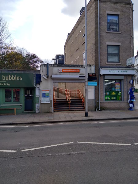
Wandsworth Road station
| Postcode | SW8 4PA |
|---|
Transport
| Travel zone | 2 |
|---|---|
| Tube/Rail lines | |
| Next stations | |
| Nearby stations | |
| Bus stops |
Pensbury Street (SW)
Wandsworth Road Station (NE)
Westbury Street (SW)
Union Road Clapham (NE)
Clyston Street (SE)
Carey Gardens (SE)
|
| Station code (TLC) | WWR |
| Station code (NLC) | 5372 |
| Owner | London Overground |
| National Rail Enquiries | |
Live Departures
Live Arrivals
Usage
Entries and exits
Interchanges
| Year | Entries and exits | Annual change % | Interchanges | Annual change % |
|---|---|---|---|---|
| 2024 | 586,004 | 2.9 % | ||
| 2023 | 569,618 | 11.7 % | ||
| 2022 | 509,950 | 93.2 % | ||
| 2021 | 263,940 | -62.5 % | ||
| 2020 | 703,338 | -9.8 % | ||
| 2019 | 779,918 | -2.9 % | ||
| 2018 | 802,902 | -1.2 % | ||
| 2017 | 812,972 | -2.0 % | ||
| 2016 | 829,908 | 34.4 % | ||
| 2015 | 617,414 | 12.7 % | ||
| 2014 | 547,786 | 75.2 % | ||
| 2013 | 312,730 | 12.0 % | ||
| 2012 | 279,248 | 16.6 % | ||
| 2011 | 239,548 | 32.3 % | ||
| 2010 | 181,014 | 8.8 % | ||
| 2009 | 166,326 | 19.8 % | ||
| 2008 | 138,798 | -15.4 % | ||
| 2007 | 164,030 | 145.6 % | ||
| 2006 | 66,787 | 3.4 % | ||
| 2005 | 64,605 |
Note: Data is for financial years, so 2020 is April 2019 to March 2020
Geography
| Latitude | 51.470215 | |
|---|---|---|
| Longitude | -0.13852 | |
| Easting | 529354 | |
| Northing | 176226 | |
| Grid reference | TQ293762 | |
| UTM reference | 30U 698734 5706000 | |
| what3words | ||
| Plus code | ||
| Distance away |
Postcodes
This map shows the postcodes where this station is the nearest to the postcode (as the crow flies)