Map of Cannon Street station, London
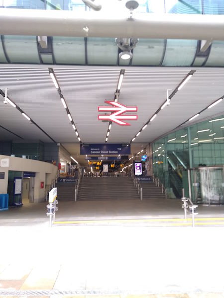
Cannon Street station
| Postcode | EC4N 6AP |
|---|
Transport
| Travel zone | 1 |
|---|---|
| Tube/Rail lines | |
| Next stations | |
| Nearby stations | |
| Bus stops |
Cannon Street (W)
Bank Station Queen Victoria Street (W)
Bank Station Queen Victoria Street (E)
Bank Station King William St (N)
Poultry Bank Station (W)
Bank Station Poultry (E)
|
| Station code (TLC) | CST |
| Station code (NLC) | 5142 |
| Owner | Network Rail |
| National Rail Enquiries | |
Live Departures
Live Arrivals
Usage
Entries and exits
Interchanges
| Year | Entries and exits | Annual change % | Interchanges | Annual change % |
|---|---|---|---|---|
| 2024 | 7,101,938 | 5.6 % | 294,166 | -21.5 % |
| 2023 | 6,723,216 | -4.3 % | 374,906 | -0.8 % |
| 2022 | 7,023,626 | 161.7 % | 377,875 | 192.4 % |
| 2021 | 2,683,600 | -85.5 % | 129,234 | -81.0 % |
| 2020 | 18,513,178 | -10.2 % | 678,921 | 62.0 % |
| 2019 | 20,614,904 | -12.1 % | 419,121 | 44.3 % |
| 2018 | 23,446,822 | 3.5 % | 290,425 | -59.3 % |
| 2017 | 22,660,250 | 6.7 % | 713,964 | -6.9 % |
| 2016 | 21,242,364 | -4.0 % | 767,110 | -67.4 % |
| 2015 | 22,129,604 | 7.0 % | 2,350,974 | 406.0 % |
| 2014 | 20,689,022 | 3.3 % | 464,605 | 6.3 % |
| 2013 | 20,020,054 | -0.7 % | 437,275 | -0.9 % |
| 2012 | 20,151,830 | -1.8 % | 441,370 | 119.9 % |
| 2011 | 20,528,267 | 1.5 % | 200,675 | 4.0 % |
| 2010 | 20,229,239 | -6.5 % | 193,023 | -3.6 % |
| 2009 | 21,646,380 | -1.8 % | 200,318 | -8.3 % |
| 2008 | 22,044,568 | 4.4 % | 218,479 | 105.3 % |
| 2007 | 21,106,127 | 19.8 % | 106,413 | -22.4 % |
| 2006 | 17,613,560 | 0.9 % | 137,051 | 1.4 % |
| 2005 | 17,460,399 | 135,224 |
Note: Data is for financial years, so 2020 is April 2019 to March 2020
Geography
| Latitude | 51.511381 | |
|---|---|---|
| Longitude | -0.090293 | |
| Easting | 532623 | |
| Northing | 180888 | |
| Grid reference | TQ326808 | |
| UTM reference | 30U 701900 5710709 | |
| what3words | ||
| Plus code | ||
| Distance away |
Postcodes
This map shows the postcodes where this station is the nearest to the postcode (as the crow flies)