Map of Kensal Green station, London
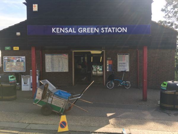
Photo: Martin W
Kensal Green station
| Postcode | NW10 5JT |
|---|
Transport
| Travel zone | 2 |
|---|---|
| Tube/Rail lines | |
| Next stations | |
| Nearby stations | |
| Bus stops |
Kensal Green Station (W)
St Mary's Cemetery (W)
St Mary's Cemetery (E)
Berens Road (E)
College Road (W)
College Road (E)
|
| Station code (TLC) | KNL |
| Station code (NLC) | 1447 |
| Owner | London Underground |
| National Rail Enquiries | |
Live Departures
Live Arrivals
Usage
Entries and exits
Interchanges
| Year | Entries and exits | Annual change % | Interchanges | Annual change % |
|---|---|---|---|---|
| 2024 | 1,026,784 | 5.5 % | ||
| 2023 | 973,688 | 15.4 % | ||
| 2022 | 843,392 | 106.1 % | ||
| 2021 | 409,302 | -61.5 % | ||
| 2020 | 1,062,492 | 68.0 % | ||
| 2019 | 632,316 | -3.9 % | ||
| 2018 | 657,950 | -3.6 % | ||
| 2017 | 682,728 | -2.5 % | ||
| 2016 | 700,526 | -20.8 % | ||
| 2015 | 884,400 | -4.8 % | ||
| 2014 | 929,124 | 4.2 % | ||
| 2013 | 891,474 | -5.0 % | ||
| 2012 | 938,836 | 12.3 % | ||
| 2011 | 835,712 | 55.3 % | ||
| 2010 | 538,126 | 20.1 % | ||
| 2009 | 448,000 | 16.0 % | ||
| 2008 | 386,121 | -0.3 % | ||
| 2007 | 387,149 | -56.1 % | ||
| 2006 | 881,370 | -5.4 % | ||
| 2005 | 931,639 |
Note: Data is for financial years, so 2020 is April 2019 to March 2020
Geography
| Latitude | 51.530539 | |
|---|---|---|
| Longitude | -0.225088 | |
| Easting | 523241 | |
| Northing | 182784 | |
| Grid reference | TQ232827 | |
| UTM reference | 30U 692468 5712475 | |
| what3words | ||
| Plus code | ||
| Distance away |
Postcodes
This map shows the postcodes where this station is the nearest to the postcode (as the crow flies)