Map of Waterloo station, London
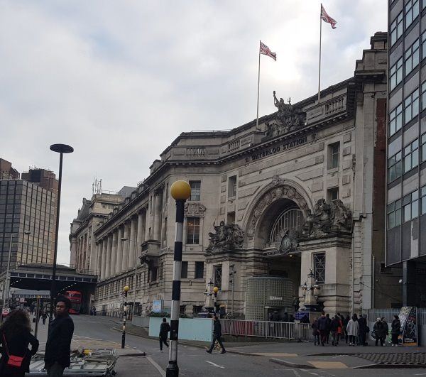
Waterloo station
| Postcode | SE1 7NY |
|---|
Transport
| Travel zone | 1 |
|---|---|
| Tube/Rail lines | |
| Next stations | |
| Nearby stations | |
| Bus stops |
Waterloo StationMepham Street (E)
Waterloo StationUpper Taxi Rd (W)
Waterloo StationUpper Taxi Rd (W)
Waterloo Station Tenison Way (E)
Waterloo Station Tenison Way (W)
Waterloo Station Tenison Way (W)
|
| Station code (TLC) | WAT |
| Station code (NLC) | 5598 |
| Owner | Network Rail |
| National Rail Enquiries | |
Live Departures
Live Arrivals
Usage
Entries and exits
Interchanges
| Year | Entries and exits | Annual change % | Interchanges | Annual change % |
|---|---|---|---|---|
| 2025 | 70,389,546 | 12.6 % | 4,464,632 | -10.9 % |
| 2024 | 62,525,274 | 8.2 % | 5,010,184 | 7.4 % |
| 2023 | 57,789,780 | 39.5 % | 4,664,322 | 32.1 % |
| 2022 | 41,426,042 | -112.5 % | 3,532,033 | 156.8 % |
| 2021 | 12,214,626 | 12.9 % | 1,375,141 | -78.2 % |
| 2020 | 86,903,518 | -7.7 % | 6,309,545 | -3.0 % |
| 2019 | 94,192,690 | -0.2 % | 6,505,658 | 11.0 % |
| 2018 | 94,355,000 | -5.1 % | 5,859,255 | -4.0 % |
| 2017 | 99,403,096 | 0.3 % | 6,105,768 | 0.1 % |
| 2016 | 99,148,388 | -0.1 % | 6,097,879 | -40.2 % |
| 2015 | 99,201,604 | 0.8 % | 10,188,921 | 1.7 % |
| 2014 | 98,442,742 | 2.6 % | 10,017,069 | 6.7 % |
| 2013 | 95,936,542 | 2.0 % | 9,389,235 | -1.0 % |
| 2012 | 94,045,510 | 2.5 % | 9,488,822 | 64.4 % |
| 2011 | 91,750,382 | 6.2 % | 5,772,501 | 5.6 % |
| 2010 | 86,397,666 | -1.7 % | 5,466,424 | 19.2 % |
| 2009 | 87,930,076 | -3.9 % | 4,587,154 | 0.3 % |
| 2008 | 91,452,130 | 8.9 % | 4,572,796 | 8.2 % |
| 2007 | 83,993,314 | -32.8 % | 4,226,542 | 5.7 % |
| 2006 | 61,036,093 | -2.2 % | 3,997,260 | 1.1 % |
| 2005 | 62,388,929 | 3,953,885 |
Note: Data is for financial years, so 2020 is April 2019 to March 2020
Geography
| Latitude | 51.503297 | |
|---|---|---|
| Longitude | -0.113109 | |
| Easting | 531050 | |
| Northing | 179933 | |
| Grid reference | TQ310799 | |
| UTM reference | 30U 700353 5709747 | |
| what3words | ||
| Plus code | ||
| Distance away |
Postcodes
This map shows the postcodes where this station is the nearest to the postcode (as the crow flies)